
Travelling again? Galavanting with Kathryn Costello
1780 – a Dane visits the Karoo, South Africa.
Once upon a time , on a hot, dry, windy day, in April 1780, literally in the middle of nowhere, a Dane claimed a spot of land in what is one of the harshest areas on earth to farm. He recorded the event by carving the story on a huge boulder which is now in…
Pacaltsdorp in the Western Cape
Once upon a time, near George, in the Western Cape, South Africa, there was an area called Hoogekraal, whose leader was the Khoikhoi, Kaptein Dikkop.

Friemersheim
Friemersheim in the Western Cape, South Africa, is the home to wonderful murals on many houses.

The Nyami Nyami of Zimbabwe.
Zimbabwe’s river denizen is the Nyami Nyami, which is also regarded as a river God by the Tonga People. It has rarely been seen, but when it swims past you, the water turns red.

The Bridges at Kei Bridge
The second bridge which had served as the rail bridge over the Vaal River at Fourteen Streams, near Warrenton in the Northern Cape, was dismantled and erected over the Kei River. This historic bridge at Fourteen Streams saw skirmishes during the Anglo Boer War and for a while, it became a Boer stronghold, when the…

The Sao Joao Tragedy
This was the undoing of Dona Leonor. Having survived a walk of over a thousand kilometres through African bush and jungle, hunger, and all sorts of hardships that a noble woman had never dreamed of in her worst nightmares of ever enduring, her nakedness was the last straw. She buried herself in the sand, refused…

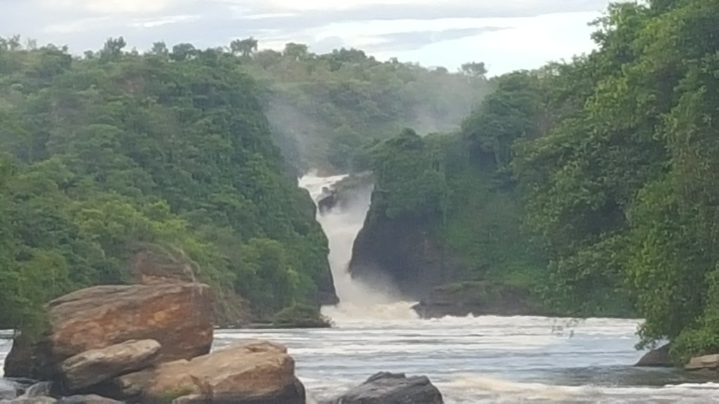
Magwa Falls and Magwa Tea Estate in Pondoland, South Africa
Magwa Falls, at 146m, are the highest falls in the Eastern Cape. They are part of the Egosa Fault, which resulted in the formation of many precipitous cliffs and narrow gorges being formed north of Port St Johns.

Nkanyamba – the river monster of Kwa Zulu-Natal, South Africa
When the monster gets angry, it takes its frustrations out on the people of Kwa Zulu-Natal, in the form of massive wind storms and rains which cause flooding. The December 2023 storm around Ladysmith was said to be an Nkanyamba unleashing its fury over the area. An Nkanyamba was also blamed for causing the devastating…

uMamlambo – The water People of the Eastern Cape
….a ‘half horse, half fish brain sucking monster’ was reported to be killing people in the area. Nine people, including children had been killed….

Graskop Gorge, Panorama District, Mpumalanga, South Africa.
The Graskop Gorge Lift Company has ensured that a good part (but not all) of the amazing winding boardwalk at the bottom of the Graskop Gorge is accessible to everybody.
Something went wrong. Please refresh the page and/or try again.
Follow My Blog
Get new content delivered directly to your inbox.
